Harnessing the Power of 3D Laser Scanning
You know you can’t do a project well without survey control. But what’s less clear for architectural, engineering and construction professionals is how and why to link survey control with 3D laser scan data.
3D laser scanners use light and radar (LIDAR) to measure and record precise locations and distances to produce a point cloud file. The technology enables you to produce highly accurate digital measurements and images quickly and easily for use throughout the project phase and structure lifecycle.
According to a paper published in Procedia Engineering, “The technology brings myriad opportunities to project managers and engineers to monitor, assess and analyze physical data captured from the environment. In addition to saving time and money to perform the same tasks with traditional methods, 3D scanning affords decision-makers with a revolutionary tool to evaluate existing conditions, assess construction progress, perform structural and cultural assessments, record as-built conditions and manage large asset portfolios. In many ways, 3D scanning lays a solid foundation for the overall improvement of information management on projects and asset management programs.”
Save Money & Reduce Risk
Sharing the benefits of survey control using laser scanning with executives, project engineers, project managers and field staff is crucial to driving interest and, ultimately, adoption. Clearly communicating why an investment in laser scanning software and training makes sense helps decision-makers understand the value and creates interest among the staffers who would benefit from the solution. It’s also important to explain to the CIO/CTO how these solutions integrate with existing technologies and makes them more useful.
Benefits include:
- Reduce errors. Survey control with laser scanning reduces time- and cost-multiplying errors. Early identification of issues cuts down on costly delays downstream that could result in lower productivity, miscommunication and avoidable fines or incorrect materials orders. For example, the laser’s accuracy eliminates false readings caused by human error and delivers the 1/8-inch or less accuracy that projects require. And you can instantly detect mistakes when you overlay the point cloud data onto the model — all of which improves overall project profitability.
- Improve efficiency. Laser scanning is labor-efficient. By some estimates, you can trim onsite data-capture time by as much as 70% over traditional surveying. Since results are so accurate, you don’t have to revisit the site for new measurements. The data gathered is easily integrated into BIM systems and quickly shared across the entire project team.
- Better safety. The technology also improves safety by allowing you to scan from a remote location protected from site hazards or treacherous terrain. This reduces the risk of crewmember injuries that drive up insurance premiums, reduce your available workforce and potentially trigger fines.
Get the Most from the Technology
“Review the field and operations workflows so each group understands what’s required to produce and use the scans before implementing them.”
When considering adding 3D laser imaging, it’s important to keep in mind best practices for its use in order to make sure you get the most from your investment. By understanding this, you can train staff and work to make implementation easier and faster from the beginning.
- Ensure collaboration between the field and operations. When field and operations techs understand each other’s requirements and workflows, they communicate more clearly, collaborate more effectively and make better Review the field and operations workflows so each group understands what’s required to produce and use the scans before implementing them. When possible, cross-train one or two people from each team to be proficient with field and processing procedures.
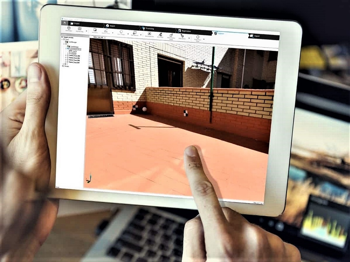
- Place targets strategically in the field. Targets must be positioned correctly to produce accurate scans. System algorithms need three reference points or more on each project to enable accurate registration. Choose locations that aren’t likely to move — not a temporary railing or a stake, for instance — because that will negatively impact the coordinate system. Place targets spaced apart widely and at different elevations around the site to give the laser plenty of reference points. Don’t place targets in a straight line or in a repeating pattern, which makes it harder for the scanner to define spatial relationships. Understanding how to position targets will help you quickly get the results you need from the first scan onward.
- Perform rigorous QA/QC. It can be tempting to put too much trust in the software, but it’s your responsibility to verify that things are measured, registered and delivered properly. It’s especially important to use survey control for large, data-intensive projects. Sometimes there’s a hitch in the automated target identification or registration process. For each scan, validate targets by matching those in the scan with those you know are in the field and remove things that are incorrectly identified as targets. Investing extra time for a close look before pushing anything out to the client or project partner keeps errors from cascading through the project.
Evaluate Solutions
Now that you know the benefits and some best practices, you’re ready to choose a survey control solution with 3D laser scanning. Consider these factors when evaluating options:
- Does it meet all your firm’s needs? These solutions are important investments so choose software that has everything your teams need. Make a list of the features and functions your staff must have right now plus those you anticipate needing in the future; then add the nice-to-haves. Vet possible solutions against your list to ensure that the ultimate choice meets your firm’s specific needs for scanning, processing and delivering as-built data capture and 3D visualization. If you’re already working — or plan to work — remotely or virtually, don’t forget to assess each solution’s mobile and cloud functionality.
- Verify interoperability and integration with existing systems. It’s vital that your new solution integrates with your existing technology stack. Inventory your current software and hardware and check it off against each solution’s requirements and functionality. You also want to make sure the software supports major laser scanner manufacturers’ data formats and is easily integrated into BIM. Bonus points if you consider compatibility with partners’ technology solutions, to ensure easy collaboration and data transfer. If you know your firm will grow, double-check each option’s scalability.
- Investigate provider reputation. Because AEC projects typically have a long lifecycle, you’re better off choosing a technology partner that’s going to be there for you. Give special consideration to providers with proven track records and trusted software and technology. Review case studies and talk to colleagues about the providers they work with to vet each potential partner.
- Choose a provider that offers training and support after the sale. Users need training to effectively and efficiently use the laser scanning hardware and software. Go with a provider that sells a complete package of training and support. On- or off-site instruction upfront is critical, as is ongoing support for upgrades and new feature sets. You also want a sales engineer to help you develop workflows, streamline processes and troubleshoot. Ongoing technical support is critical.
- Test-drive the system. Demos are nice, but they aren’t a reliable indicator of real-world user experience. Because your team will use the solution every day, it’s essential that staff test-drive the software and hardware to evaluate ease of use and other factors.
Consider a Portfolio Solution
“Investing extra time for a close look before pushing anything out to the client or project partner keeps errors from cascading through the project.”

A portfolio solution that includes all the hardware and software necessary for survey control with laser scanning is the best way to meet your firm’s needs and deliver maximum return on investment.
For example, FARO® provides 3D hardware and software solutions for as-built data capture and 3D visualization that are specifically designed for the architecture, engineering and construction sectors. The technology enables professionals to transfer real-world information into the digital realm. The seamless solution and workflow make capturing data efficient and accurate so you can process it into deliverable CAD plans and BIM models.
Use this information to champion survey control with 3D laser scanning at your firm and to purchase the best technology you can afford. The right laser scanning solutions give professionals the power to gather, manage and analyze actual conditions for better planning, verification and site and industrial facilities maintenance.
